People
Projects
Publications
Data Tools
Connect
People
Projects
Publications
Data Tools
Connect
Data Tools
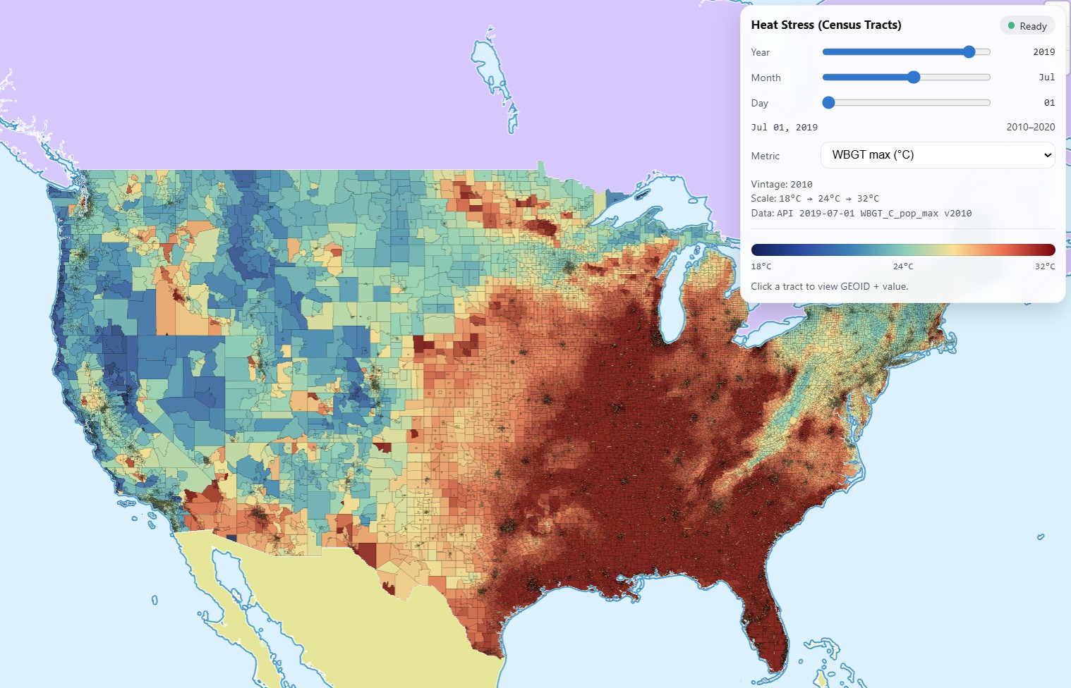
Heat Stress Atlas (U.S. Census Tracts)
Explore tract-level min/max extremes of HI, WBGT, and UTCI to pinpoint where heat exposure is most severe and support neighborhood-scale climate planning.
Try it Now